Belgian fire station
This modern fire station was designed with preparedness and response in mind. There's easy access to the motorway and extensive training areas
Architect: Philippe SAMYN and PARTNERS, architects & engineers
About the project: Considering the specific characteristics of the site, the architecture of the project is simple, contemporary, compact and functional (flow of people and vehicles) while offering an iconic and recognisable form, compatible with the firm tertiary character of the environment.
Easy access to the nearby motorway is essential for the station's location. It is therefore crucial that the selection of this site is reinforced by the fast and safe transport of vehicles and people in case of emergency. Consequently, all efforts are made in order to reduce the response time of the fire station.
The location of the building is the result of a study aimed at combining the responses to the constraints given by the site: large drop, neighbourhood, driveways, low ground bearing, wind direction, solar orientation, etc.
The location of the building, in the upper and flattest part of the ground, limits the excavation and backfill associated with the construction. The two existing driveways, the first used for emergencies and the second for personnel and visitor access, are positioned in order to limit the length of the roads.
The hollow made by the south access creates the entrance to the building at ground level (pedestrians, bicycles and cars), as well as an area accessible to delivery vans. Access to the west, which is higher, establishes the first level of the building as the emergency level. This level is surrounded by an emergency ring road, allowing each truck to leave independently from the others by a sectional door assigned to it.
The true backbone of the project is the north-south axis, naturally indicated by the access to ground level. This is the main horizontal circulation, punctuated by all the vertical circulations, thus defining the building’s orientation.
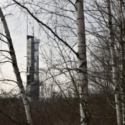
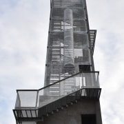
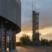
The drill tower, situated across the emergency road at the junction of the north-south axis and the emergency vehicle access road, is visible from this axis. It is surrounded by a concrete exercise area to the north, allowing trucks to easily turn around the tower and to simulate fires. The site report suggests establishing the area for fire drill exercises to the north of the field, in order to avoid smoke drifting toward the neighbouring houses.
The south-east area follows the uneven ground in order to limit, as much as possible, the construction footprint on this green site.
It naturally joins the outdoor sports field, established as a continuation of the delivery area. The site is fully secure, thanks to a continuous barrier, with only three separate and secure access points: the "emergency" access point, the "entrance" access point and the "delivery" access point.
To the south, a red wall of perforated plates emblazoned with the Regional Fire Service shield, separates the car park from the delivery area and extends up to the road, marking the entrance to the site.
The rest of the level, falling within the ring road, includes the mechanical workshop, emergency changing rooms, storage and maintenance rooms for equipment and truck (masks, tanks, hosepipes, etc.). A logical pathway connects contaminated elements, near to the back of the emergency area, and the clean elements on the side of the first emergency trucks.
Story by: Trends
Home kitchen bathroom commercial design


